
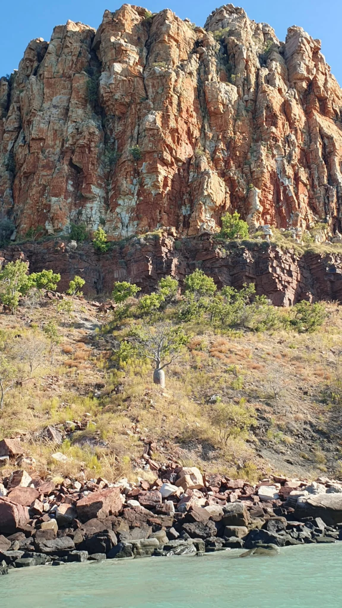
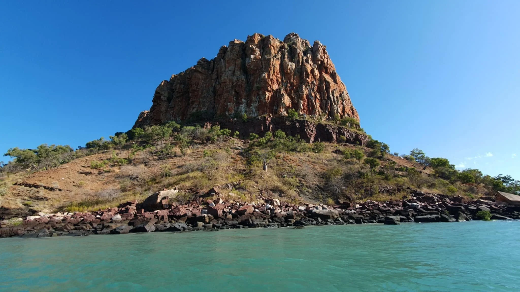
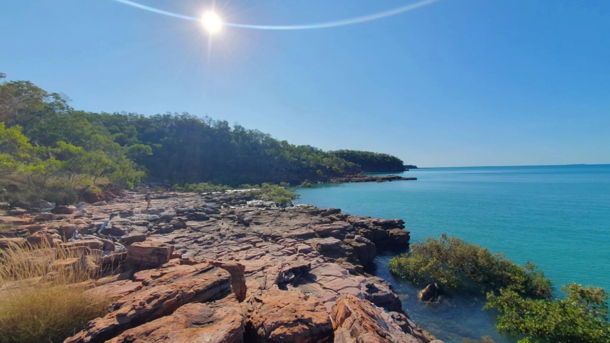
Raft Point
Part of our preparation for our Kimberley journey has been reading up on the history of the area and in particular the work of Phillip Parker King and John Lort Stokes, who basically explored and charted these areas back in the 1800’s.
Phillip Parker King was the first to properly survey and chart the coast, but because of the sheer size of the areas there were a lot of places that he didn’t go into. ‘King of the Australian Coast’ is a book which covers the voyages of King in the ships, the Mermaid and Bathurst. ‘Ships’ is probably an inappropriate term as the vessels were more like cutters, very basic and really not suited to the task, but at the time they were all that were available in the colony at NSW.
Parker King’s activities were followed up by John Lort Stokes in the Beagle and he did some more detailed exploring, specifically in the areas we are now traversing. ‘Mariners be Warned’ is the book which follows Stokes work around the Australian coastline with a lot of references to the Kimberley and Pilbara coast.
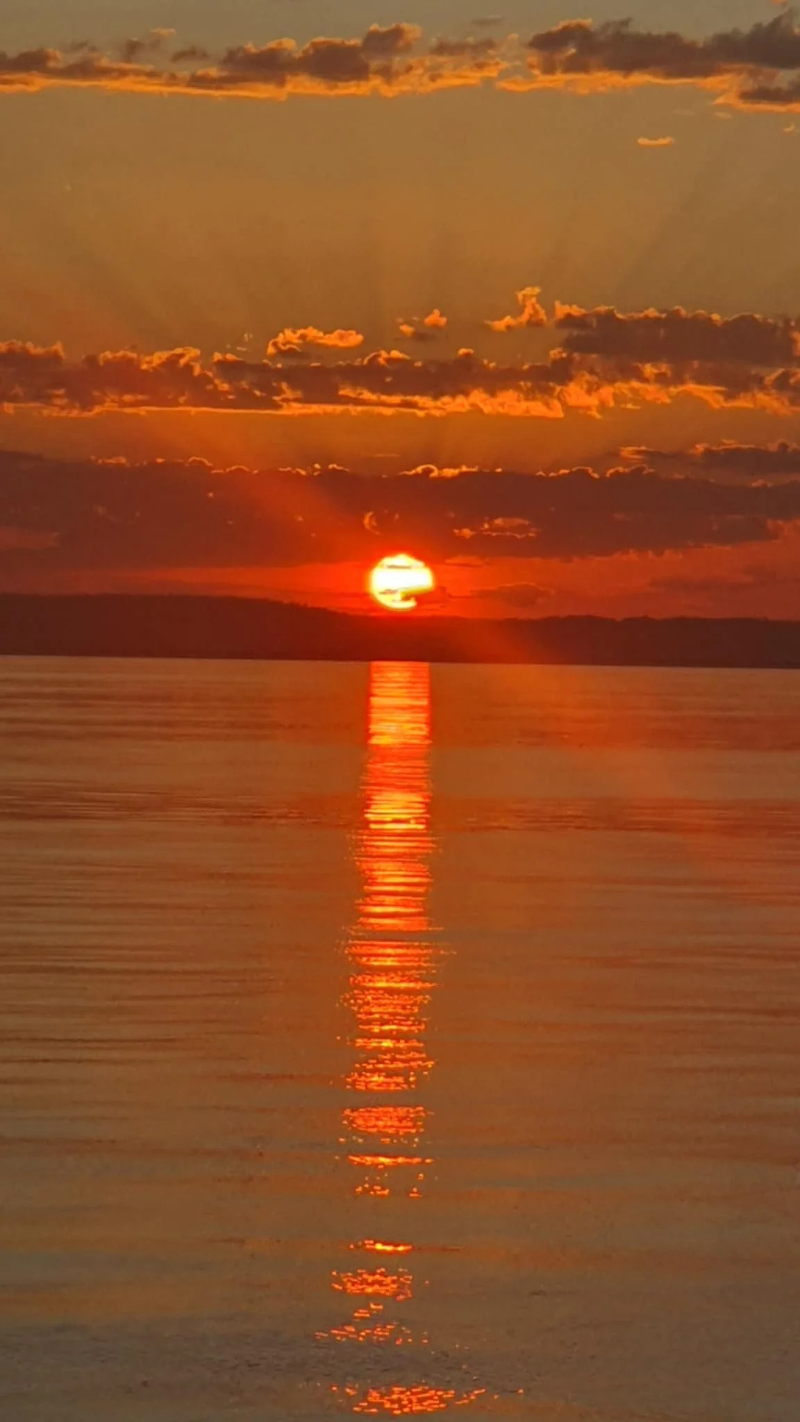
What we found appealing about these books is the fact that the coastline and areas we are sailing through today are virtually untouched and pretty much as Parker King and Stokes would have seen them back in their day. Of course we have the blessing of modern charts, satellite imagery and current and weather information, some of it thanks to them, but reading about their journeys and their battles with tides, heat and the harshness of the country fills you with admiration for their resilience and determination and we really understood how tough it must have been for them.
Our next stop was Raft Point, from where we planned to day trip across to Montgomery Reef. We had one stop over on the way at Melomys Island, which was a nice anchorage and we had an afternoon of exploring and fishing, before a sundowner on the dinghies opposite the drying reef in our bay.
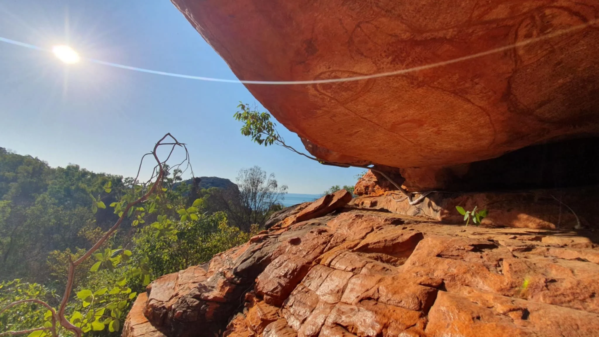
Raft Point is a well-known landmark in these parts with its towering headland and the imposing Steep Island sitting just off its shores, both of which can be seen from many miles away. We had managed to do some sailing from Melomys Island with enough easterly to fill the screecher and get us moving – at last!


We were running with the tide and the pull into Raft Point and Doubtful Bay was strong – it was over 4 knots as we got close, along with the associated boils and whirlpools that we have come to expect.
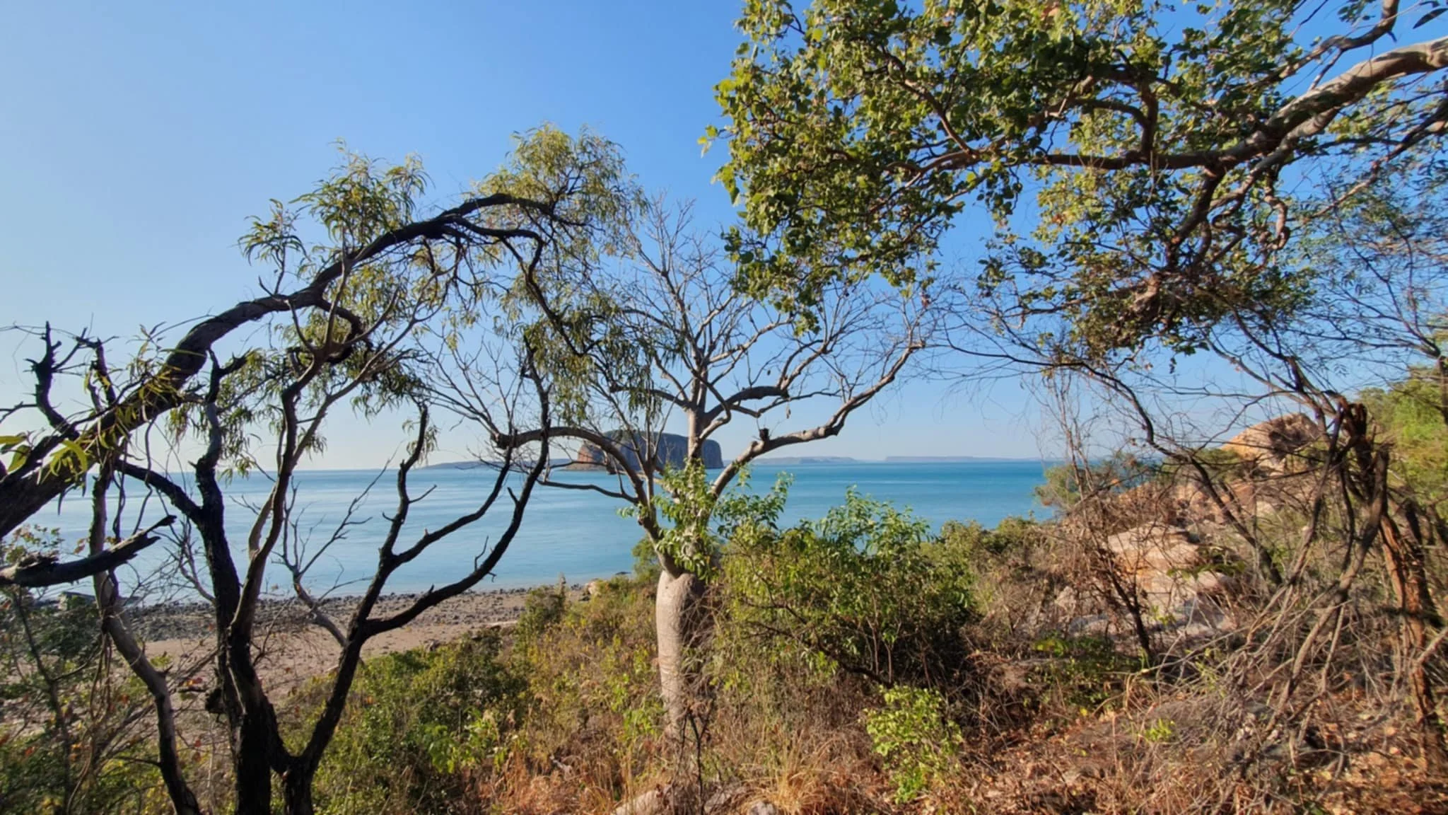
After anchoring up, which took a few attempts to set, we settled for some lunch and then preparation for some exploration. Soon we were around the corner and looking for somewhere to park the dinghies, with the tide ebbing it meant the dinghies would be left high and dry so a bit of mucking around to try and make it all work. What was exciting was the sighting of our first Kimberley Boab trees!!
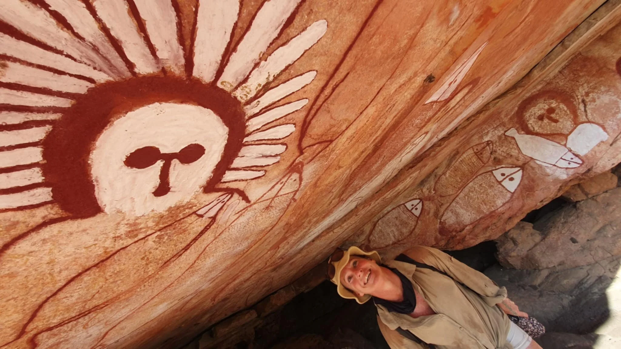
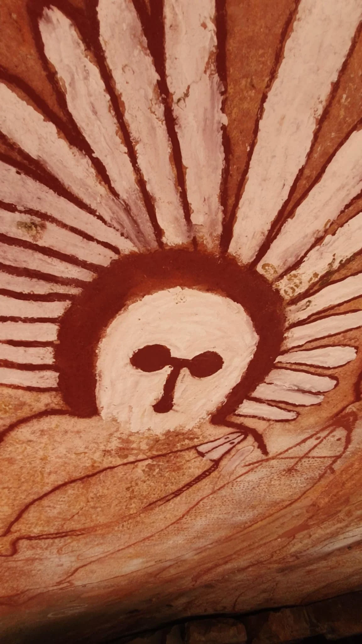
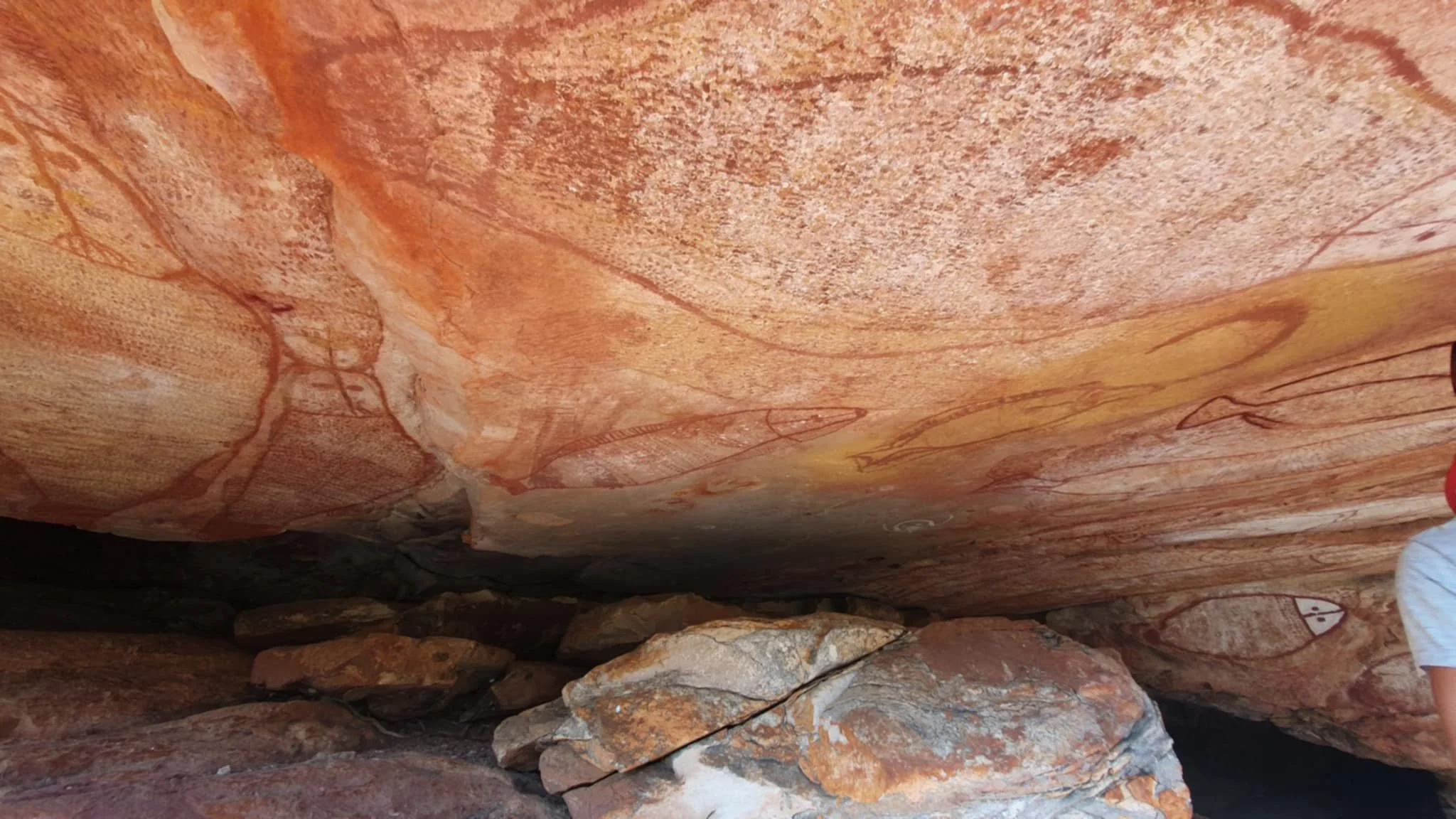
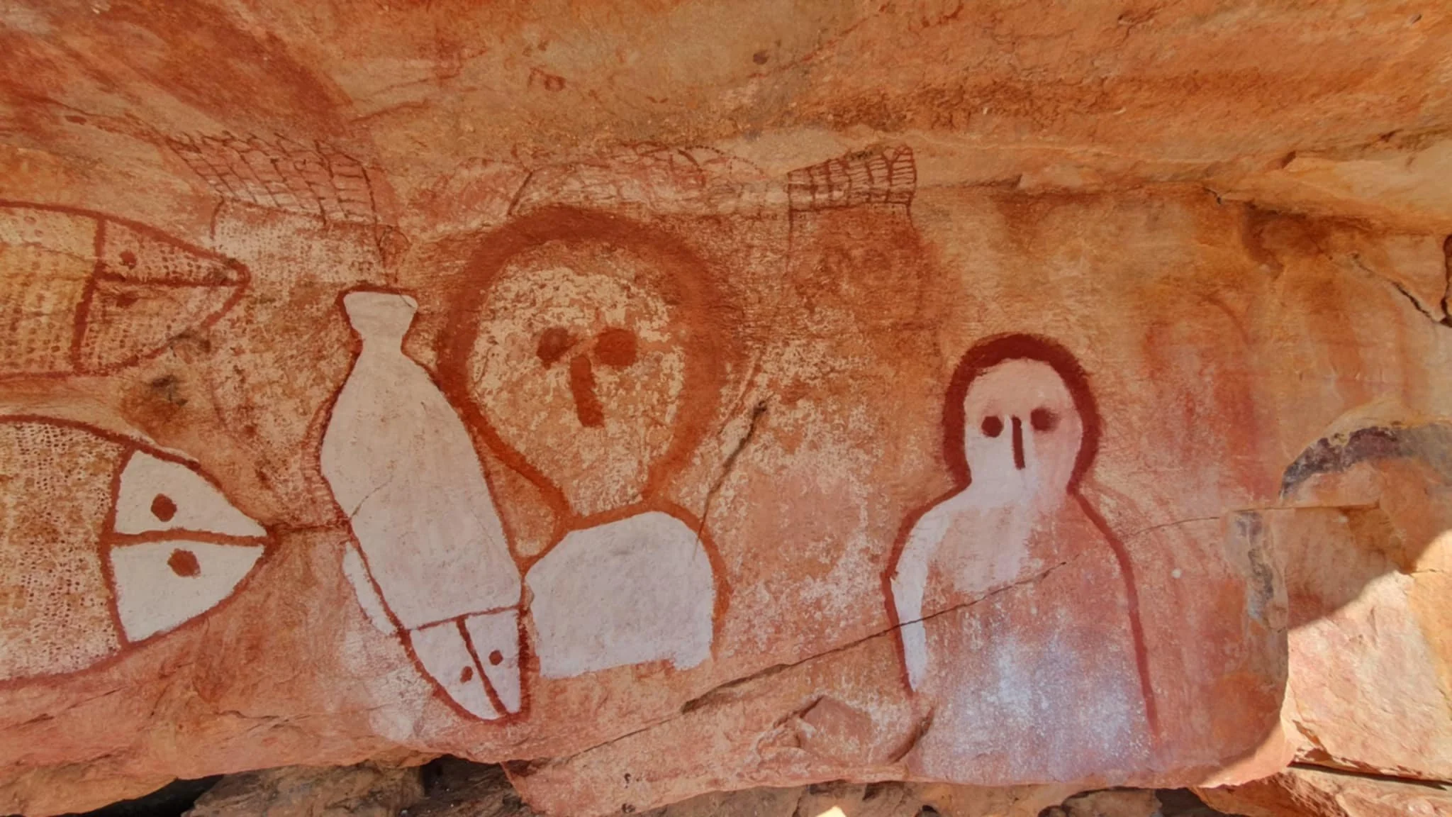
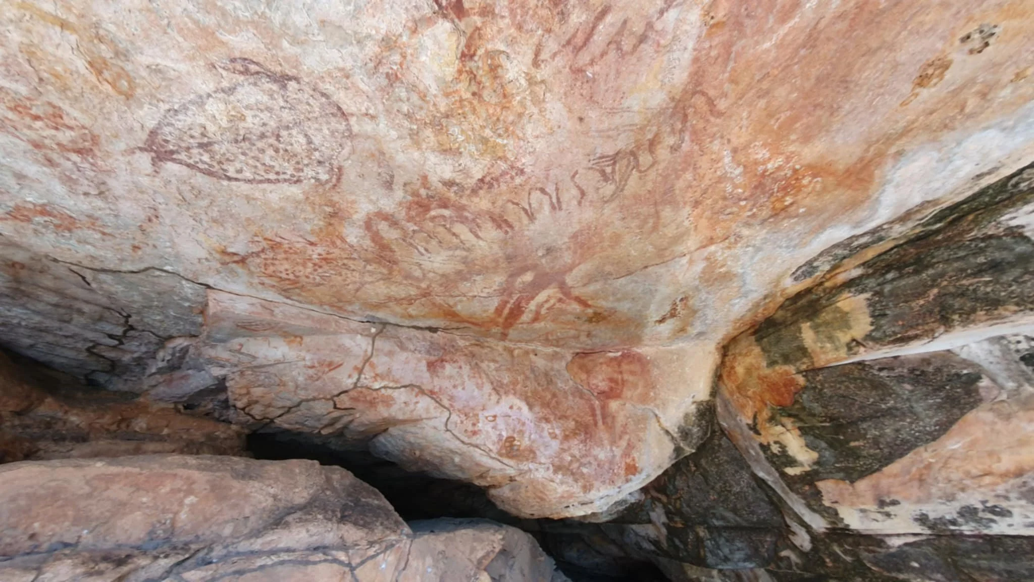
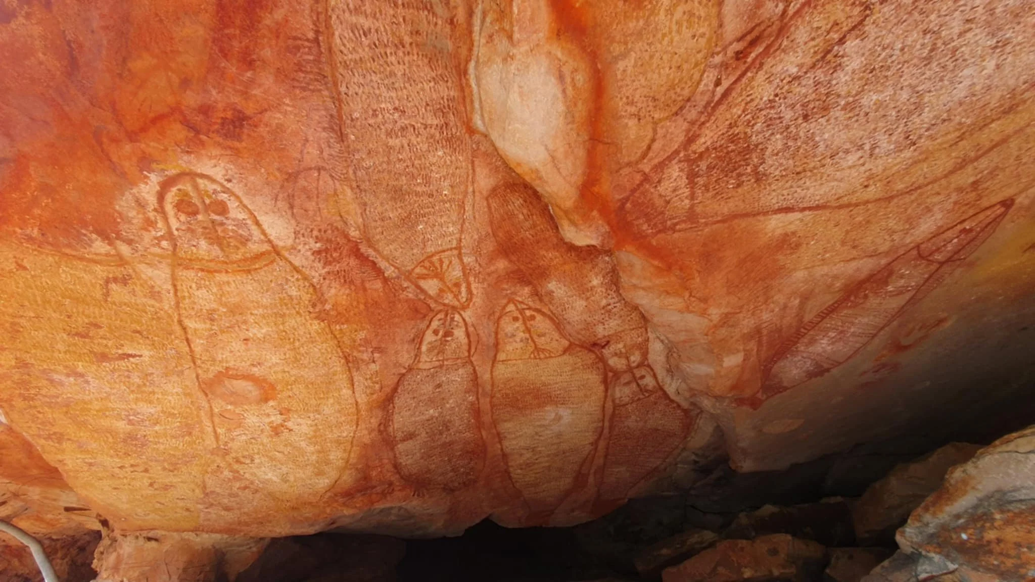
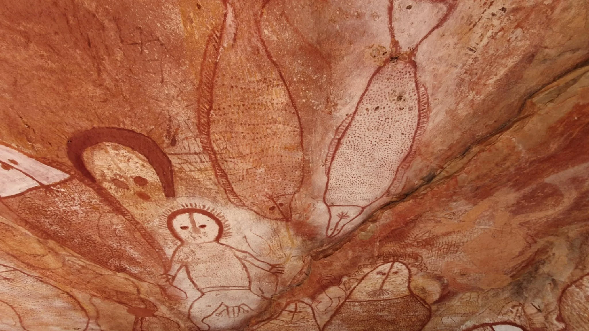
Our research had told us that there were some art to be seen up on the headland so after a little bit of scrub bashing we eventually found a small trail that lead us to a sweet gallery of rock art. There was a range of art with Wandjinas, dugongs, turtles and others all on display of the roof and walls of an overhanging ledge. Very cool to look at and sit and take in the view out of the point and imagine the early indigenous hanging out up there, hunting, gathering and sharing stories.


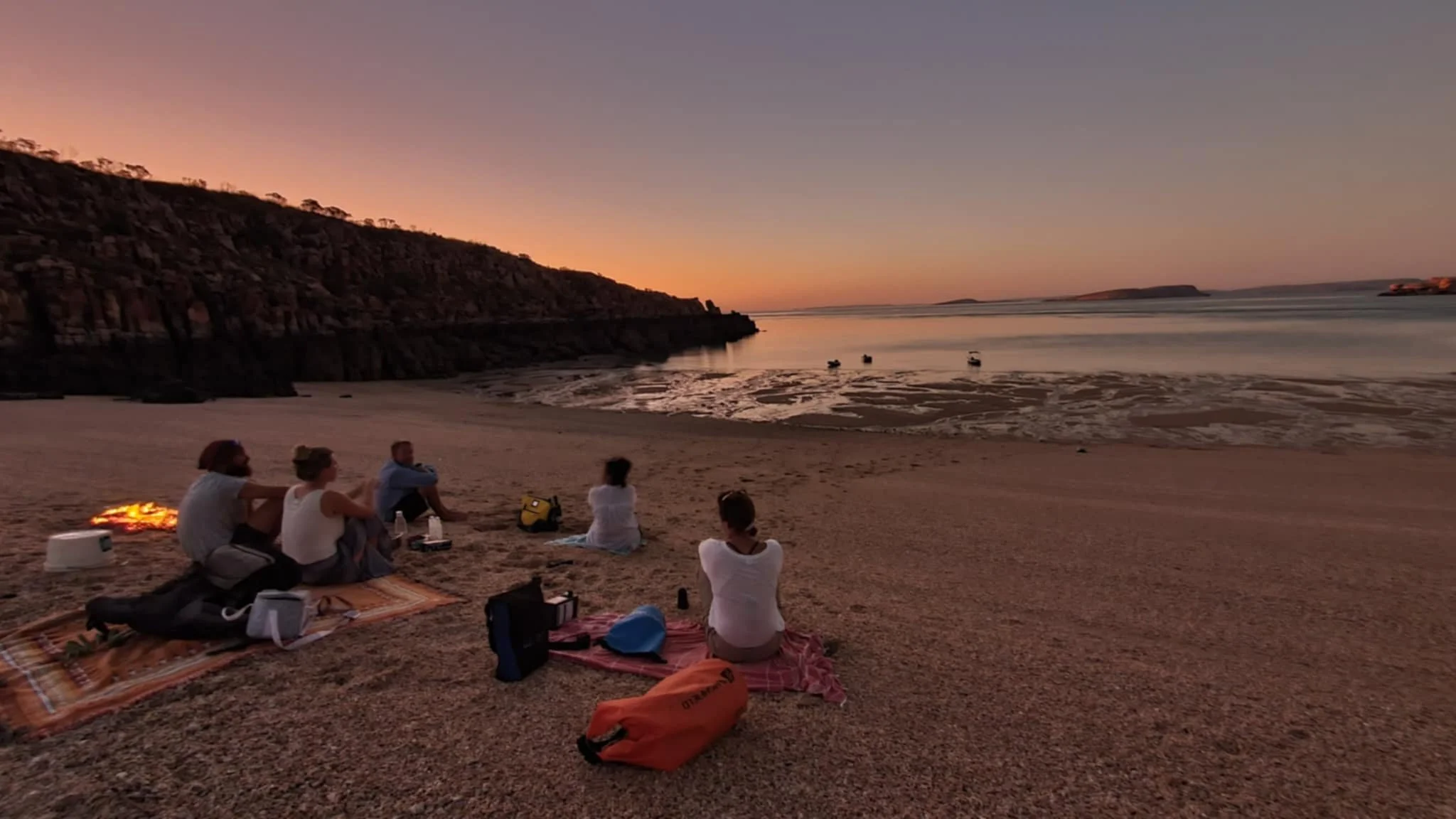
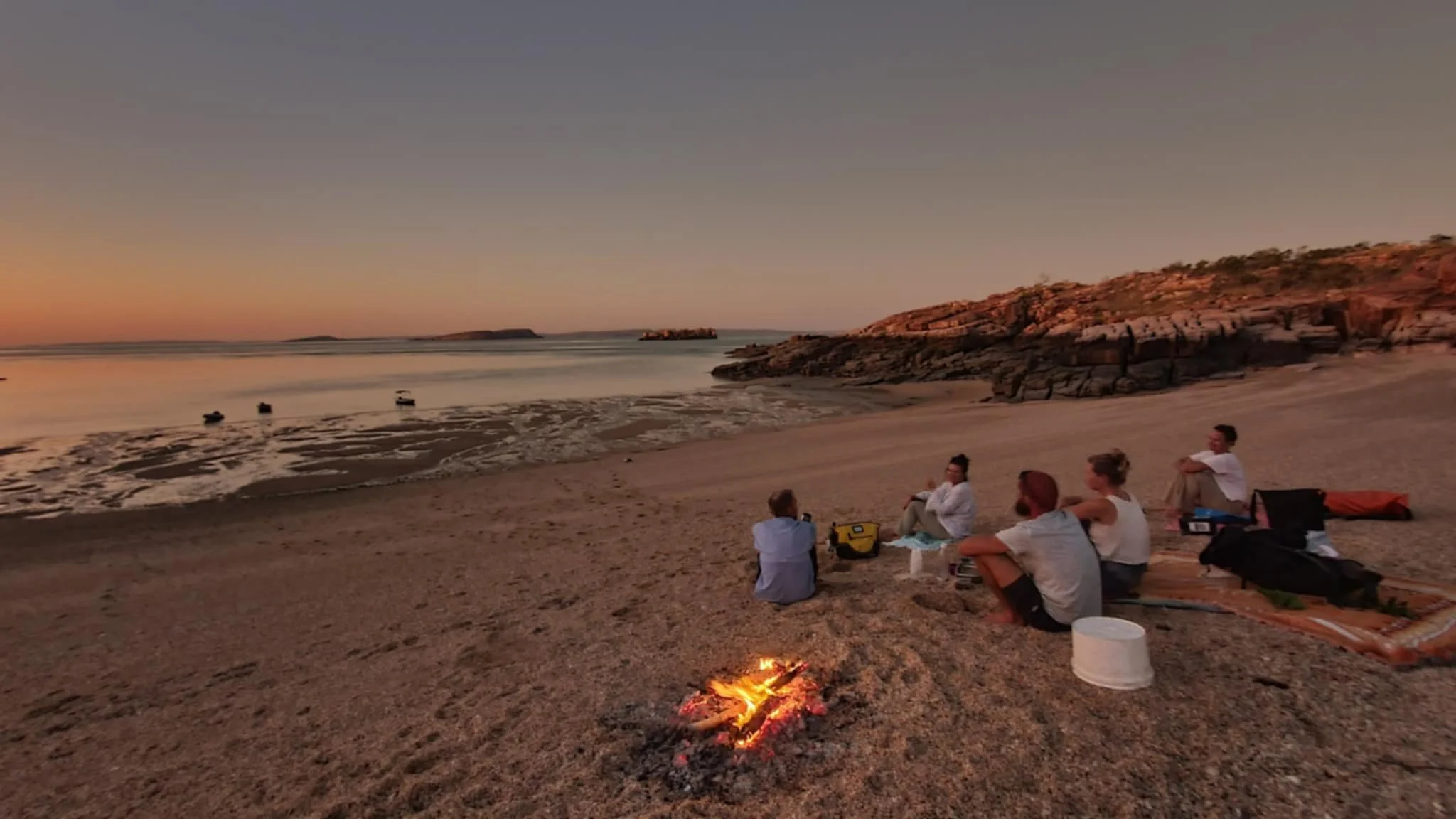
We enjoyed Raft Point and we convened for afternoon drinks on a small beach at the head of the bay. From here we took delight in taking in another magical Kimberley evening, shared with good friends.


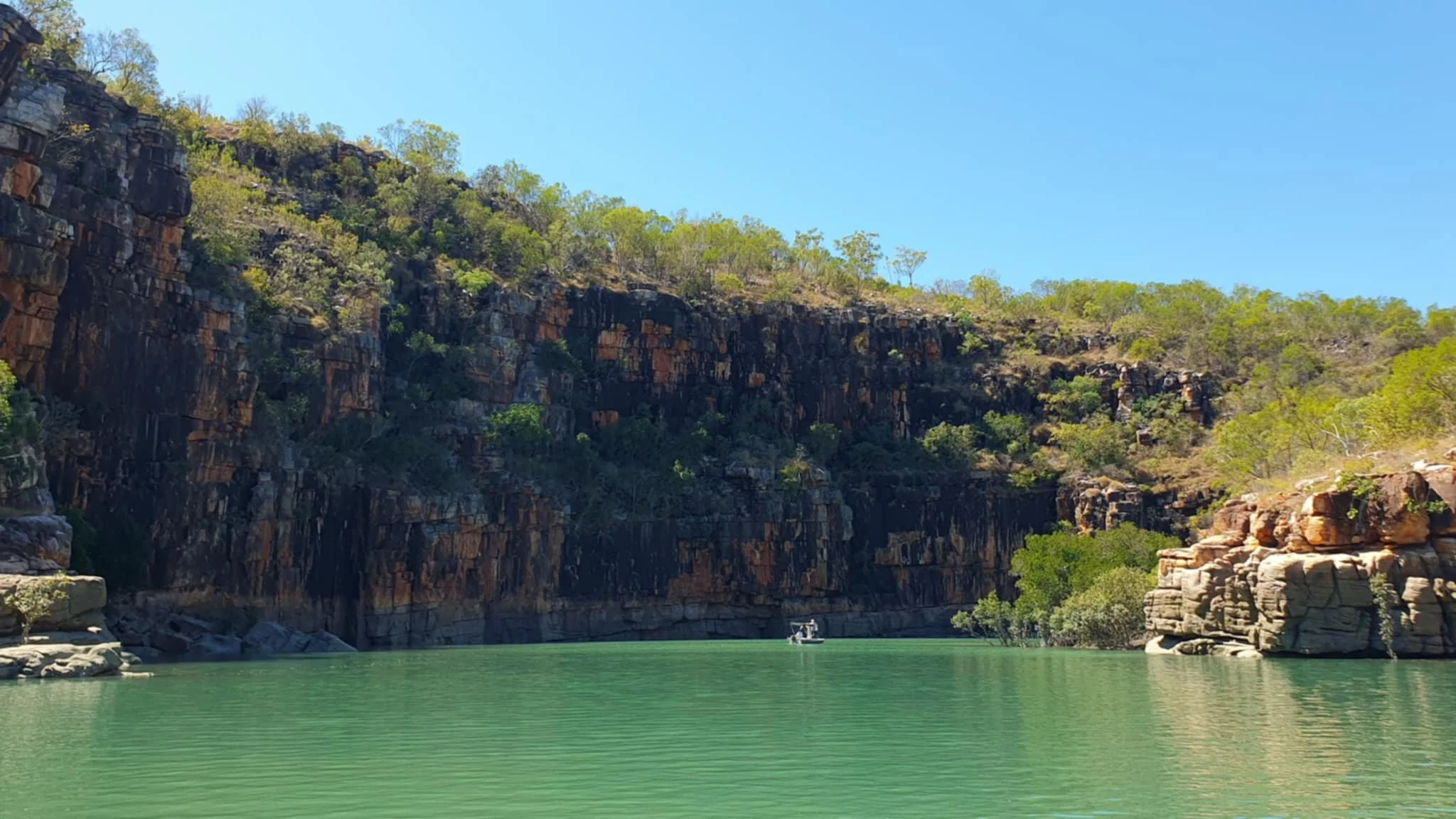
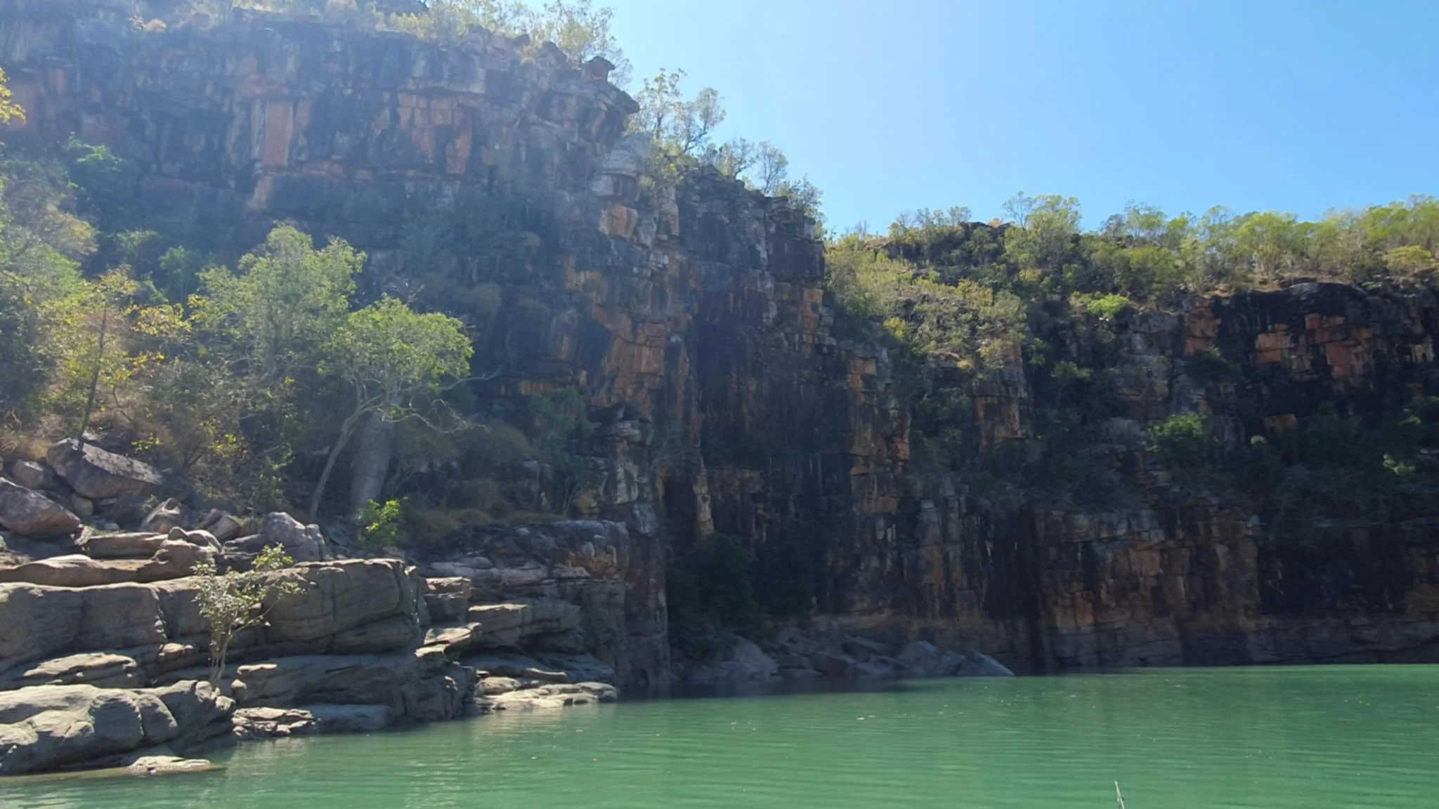
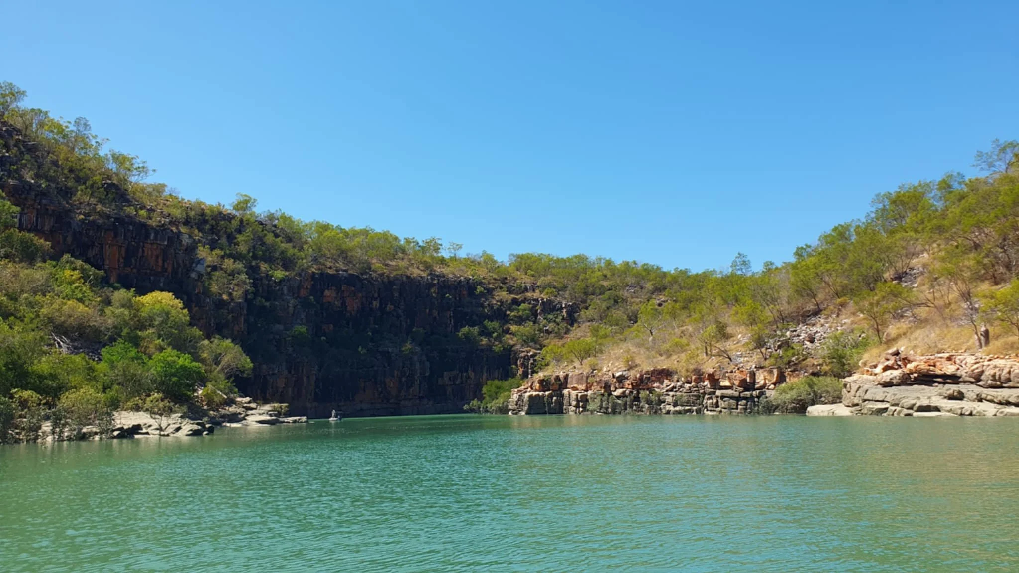
Montgomery Reef, incidentally, named after Parker King’s on-board Surgeon (who got speared and whilst recovering Parker King decided to cheer him up by naming some islands and associated reef after him!!) is another Kimberley icon that we were excited to visit. Basically, it is an enormous reef area that dries at low tide and effectively rises out of the water, creating cascading waterfalls as the water drains off the reef back into the sea. It is located about 8nm from Raft Point, so we planned to ride the outgoing tide to the reef, do some exploring and then ride the incoming tide back to Raft Point!
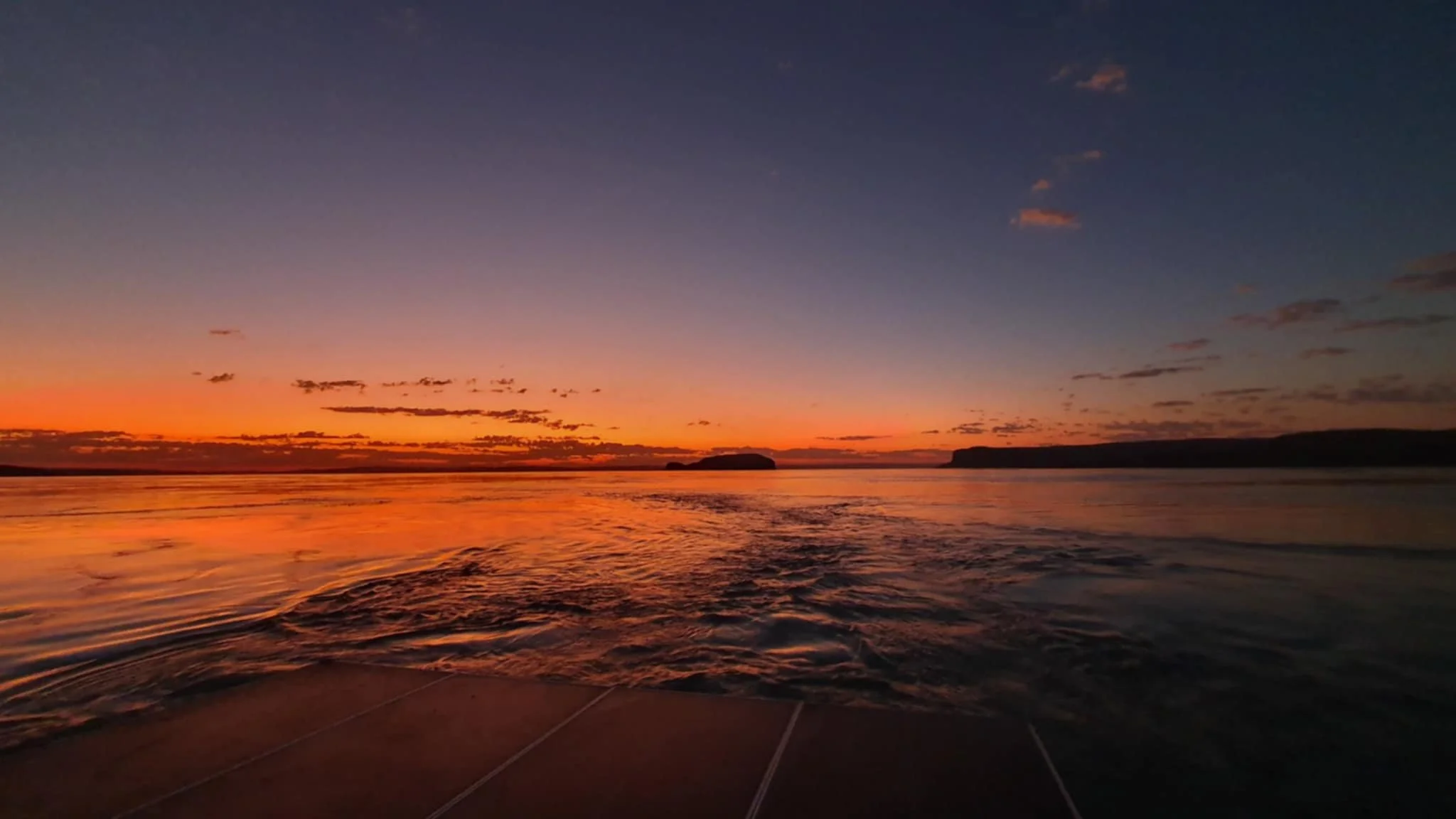
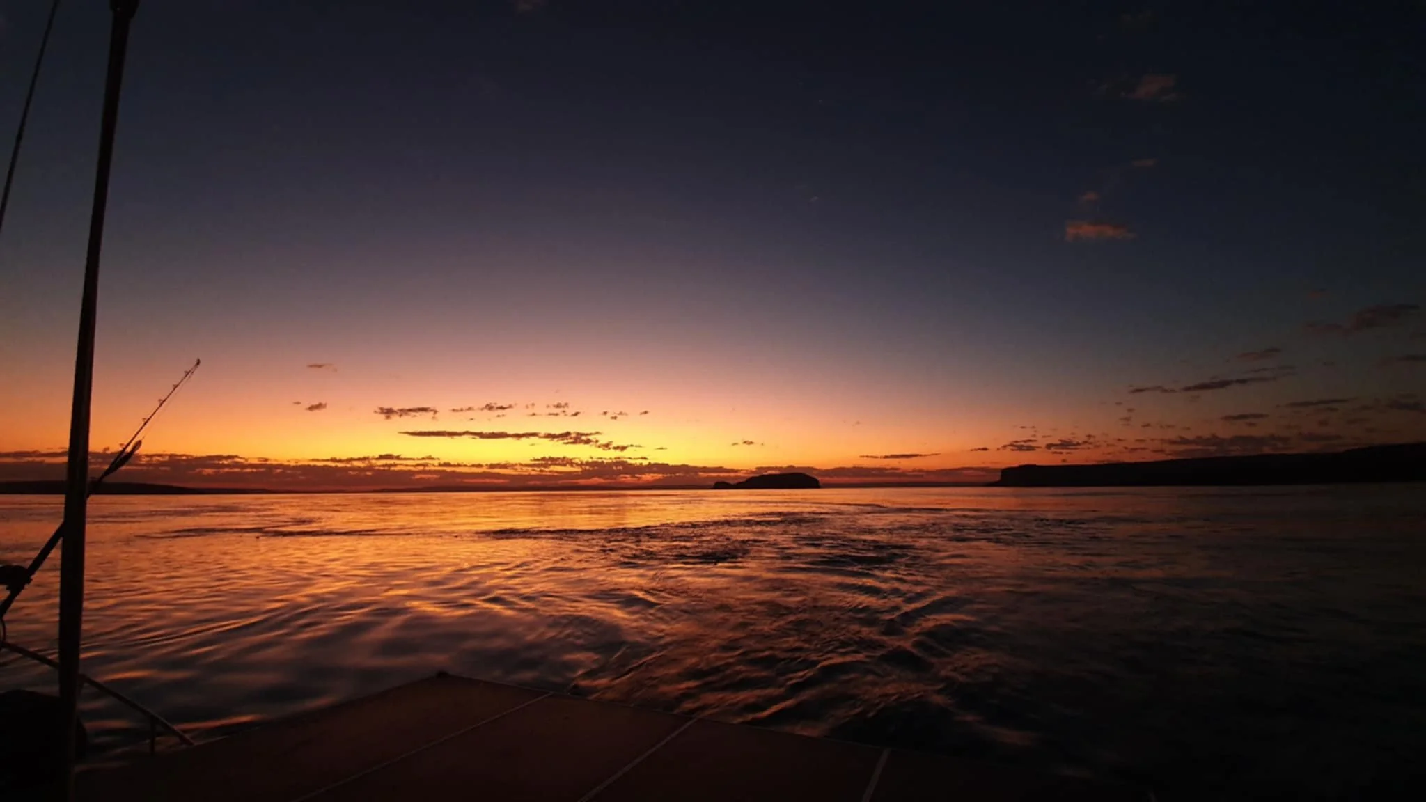
Departing at dawn we had glassy conditions as the first flickers of light came across Doubtful Bay and with an outgoing tide, that peaked at a 5 knot current (!!) we were heading west towards our destination.


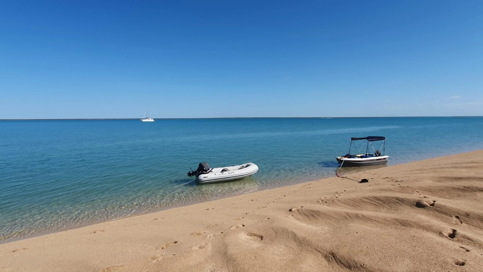

There is a large sand cay that dries out at low tide adjacent to the reef and soon we were manoeuvring our boats behind it to anchor up and then launch our dinghies. There is a natural gutter that runs for more than a mile into the reef and this is where all the action is. Sitting in the gutter, you can be up to 8 feet below the top of the reef, with waterfalls cascading everywhere you look, as the reef is drained by the tide. Turtles, fish and even squid populate this water and birds are perched on the reef adjacent to the waterfalls looking for an easy feed of fish.
The further you got down the gutter the tighter the passage becomes and the stronger the current until you reach right to the end where there are full blown rapids as tons of water is coming down. Amazing place to visit and take in, easy to see why it is a popular destination with the cruise ships.
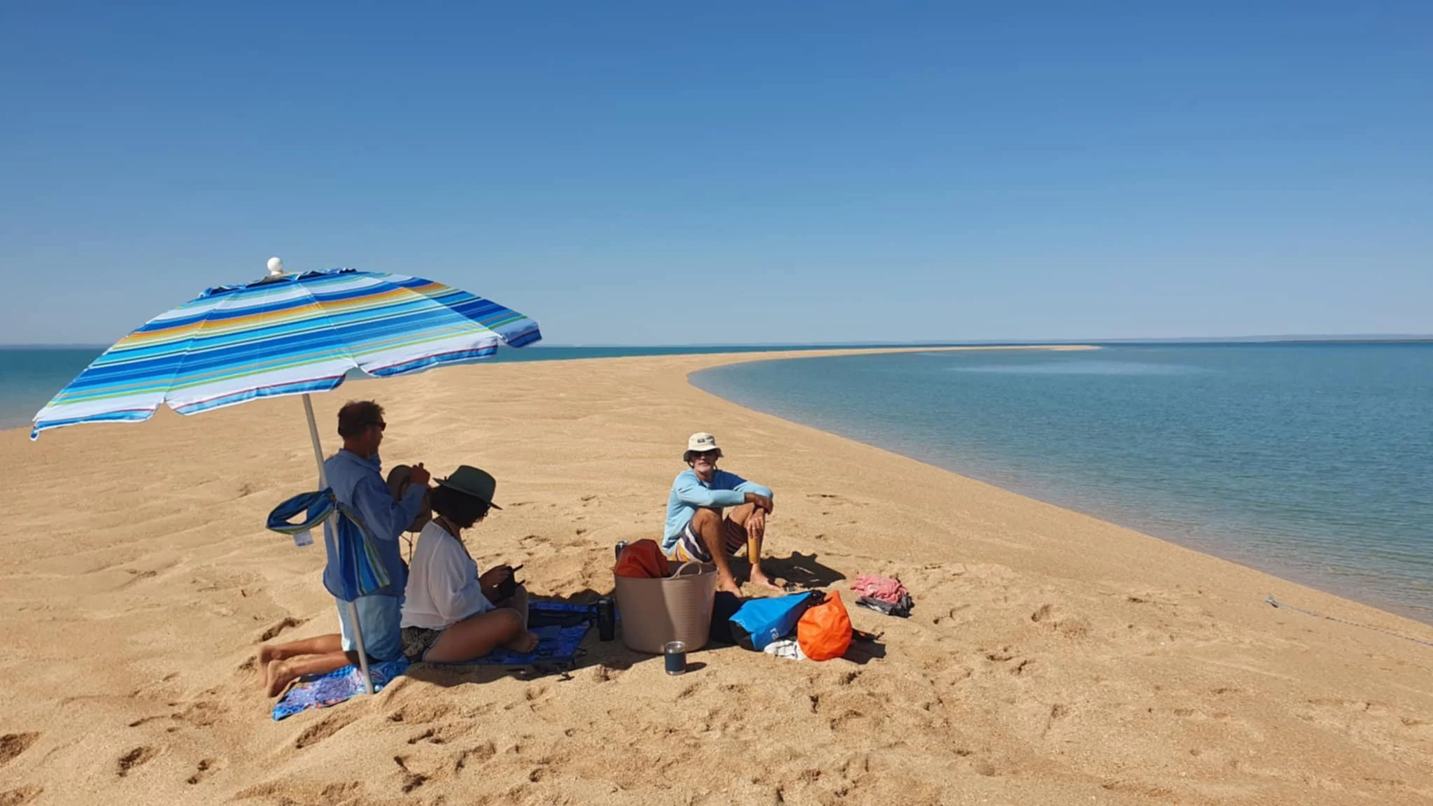
We returned to our boats and after grabbing some morning tea headed into the sand cay where we pulled out the beach umbrella, had a cuppa and a swim. Within an hour the sand cay was completely gone as it was engulfed by the rising tide. This was our cue to return to Raft Point for a lazy afternoon, which included a fire on the beach and some good cheer with our cruising mates. Seb and Corban were heading off to the Sale River and then back to Broome and we were continuing north.
Our run the next day was to Hall Point, a distance of about 30nm, which again we left with the outgoing tide to ride along with it, once more being able to do some sailing. Out timing was about an hour out as with about 3nm to go the tide changed and we were trying to round Hall Point with 2.5 knots of current on the nose – Doh! The last few miles seemed to take forever and just reminded us how important it is to travel with the tides - not try and fight them!
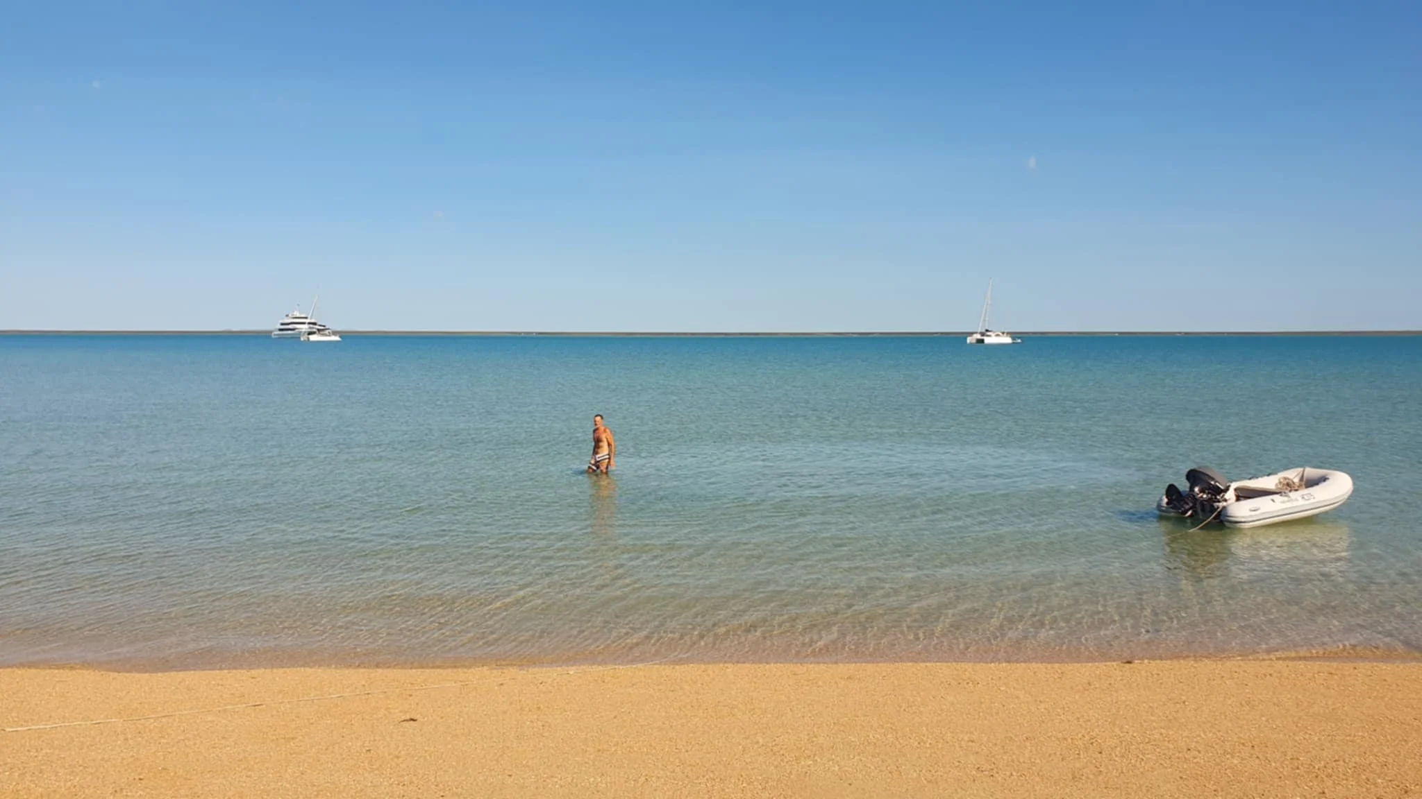
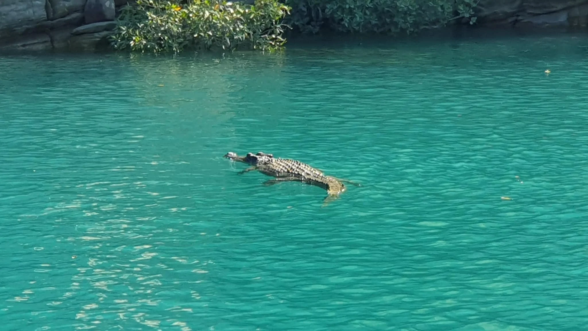
We had a couple of nice days at Hall Point where there are some lovely beaches. After our arrival we decided to go in at high tide to stretch the legs and I was thinking about a quick swim. As we were pulling the dinghy up onto the beach I looked across towards the eastern end of the beach – only to see a croc just strolling down the sand to the waters edge! No swimming here!!
A short hop from Hall Point is Deception Bay, where we had been told was a great creek system with a nice gorge and good fishing. With some whales entertaining us we hopped the 2 miles across to the entrance and then tucked into a nice shallow anchorage around the corner, out of the wind and any swell.
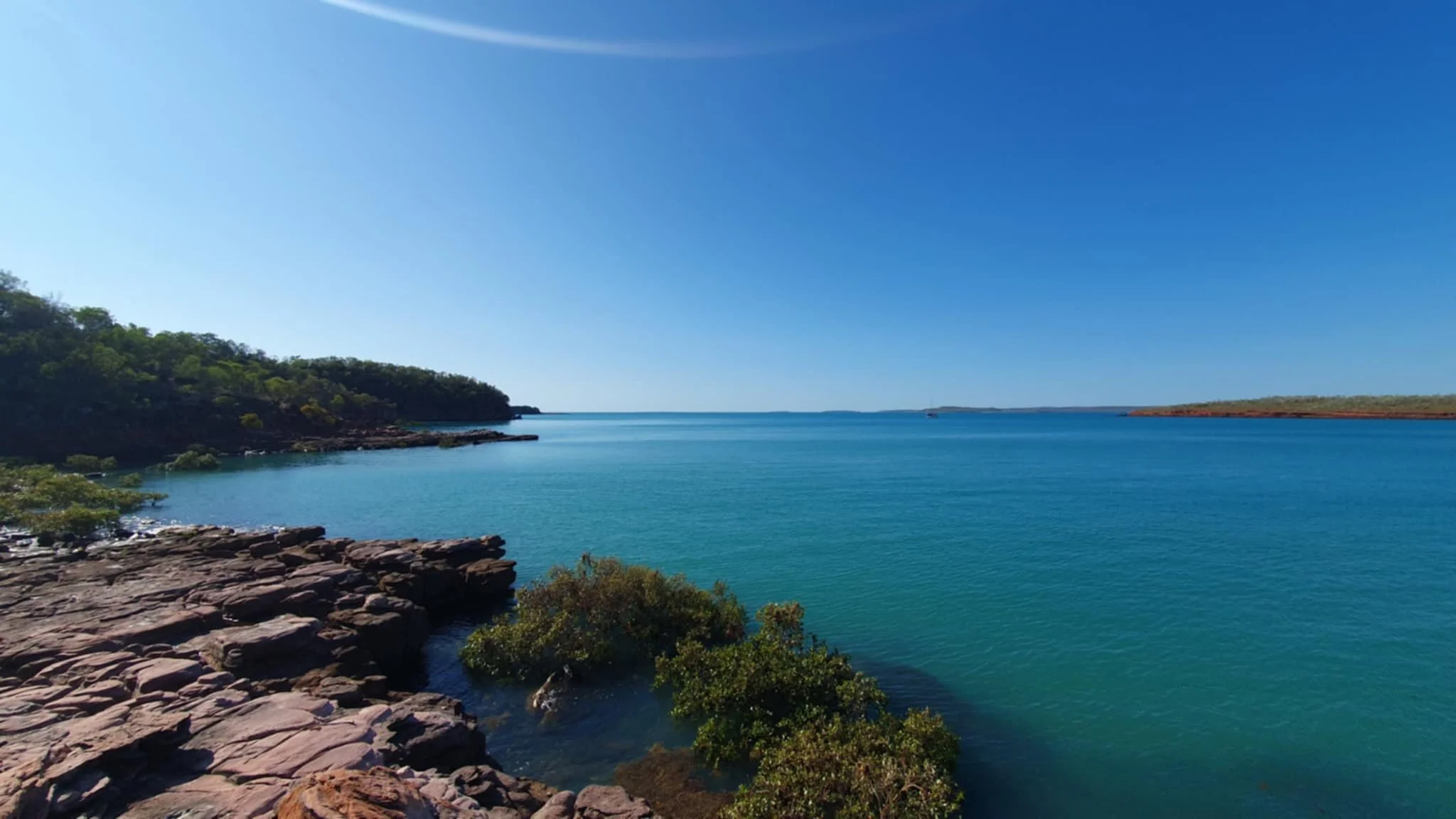


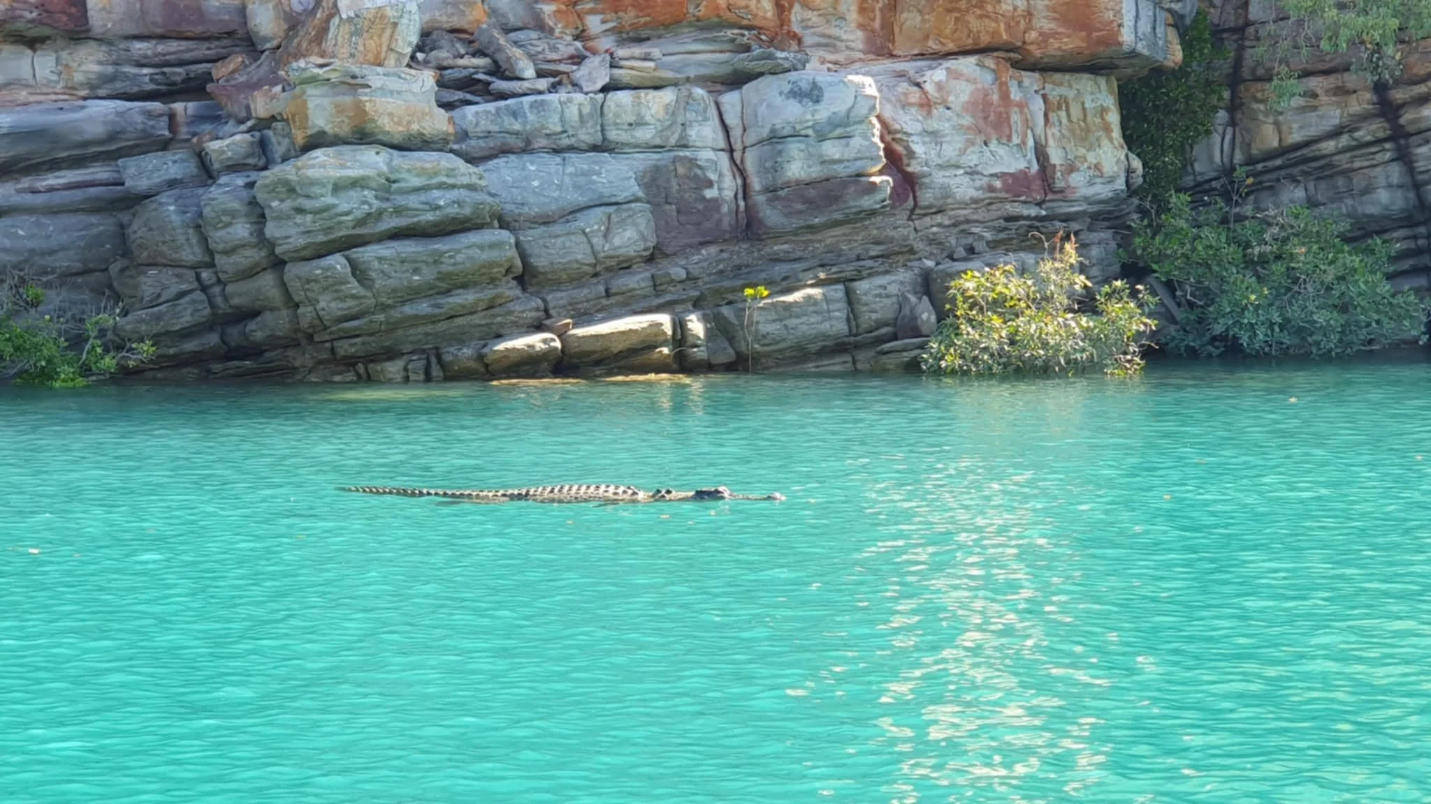
Bob was soon in the water and armed with fishing rods we set off to explore. Like most of the Kimberley coastal creeks you need to work the tides and once you get inside the creeks are quite extensive, with tributaries running off in various directions. Of course it goes without saying that along with the mangrove systems there are usually 100 to 300 foot cliffs faces and amazing rocky outcrops that from gorges as you travel upstream. We are often just drifting with the tide, throwing lures and gazing up in awe at the scenery and wildlife – mind blowing.
We had a great four hours of exploring, some croc watching (who was watching who?), fishing and again just soaking in the Kimberley experience.