
Depuch Island
With the easterlies finally forecast to be abating we were keen to get moving. Our plan was to travel up Flying Foam Passage with the tide in the early morning, anchor up on the inside of Dolphin Island for a few hours and once the easterly had swung to the north then head for Cape Lambert, which is on the western side of Point Samson.
Flying Foam Passage is a cool piece of water that tracks between the islands north of the Burrup and provides access into the large body of water that is Nickol Bay, on which Karratha sits. The passage has quite strong tidal currents and the currents actually run conversely to what you would think; i.e. when the tide is coming in it runs out of Flying Foam Passage and vice versa. We had planned for an early departure to take advantage of the ebbing tide to push us along.
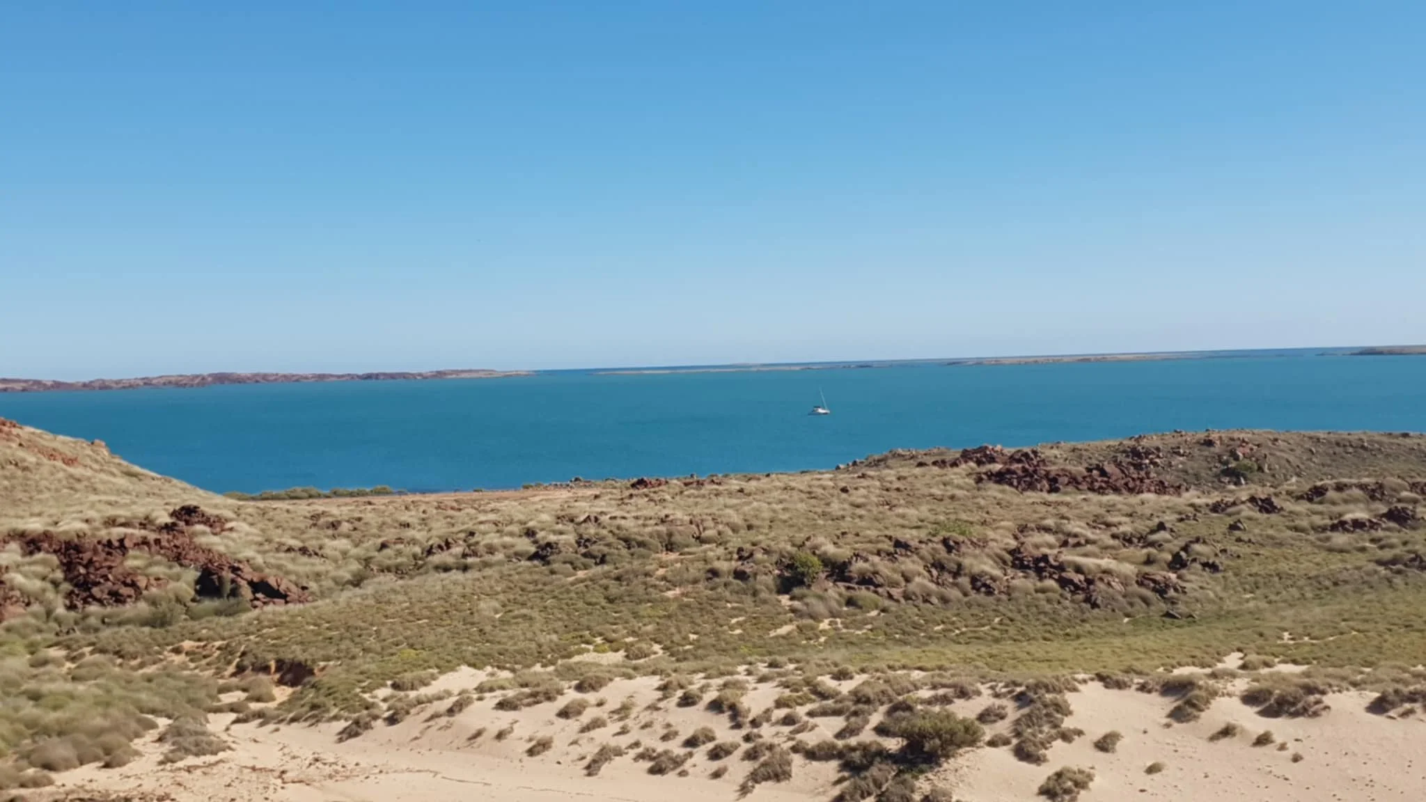
It was a great little run with picturesque islands on both sides and the passage sometimes only 200 – 300 metres wide. At one point we had two knots of tide going with us so we were happy to be playing the tide game the right way! We travelled about 9nm until we were close to the end of Dolphin Island where we anchored up and had some lunch. We had spied some interesting looking rock formations on Dolphin Island and with a few hours to kill were keen for an explore.
Whilst in Karratha we brought ourselves a backpack with a built-in water container to make it easier to take water on our walks, especially now we were getting into the warmer climates. We also brought some ‘gators’, canvas protectors that go around the top of your boots to protect from the spinifex so we were all specked up and ready to go!
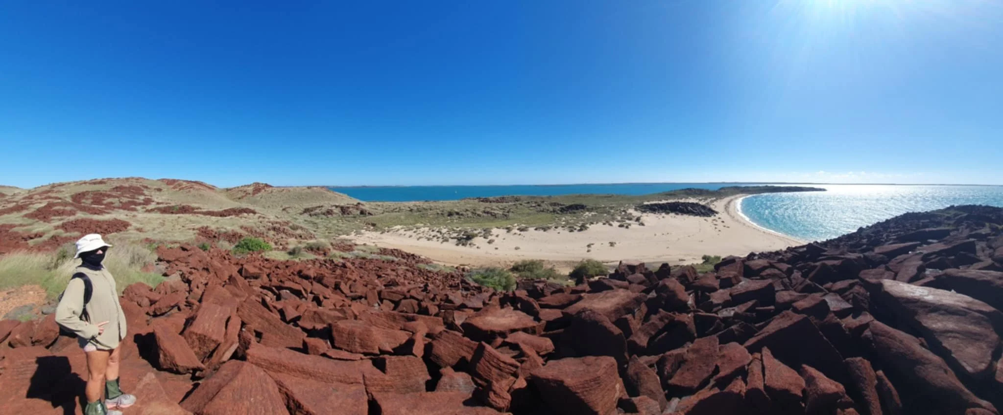
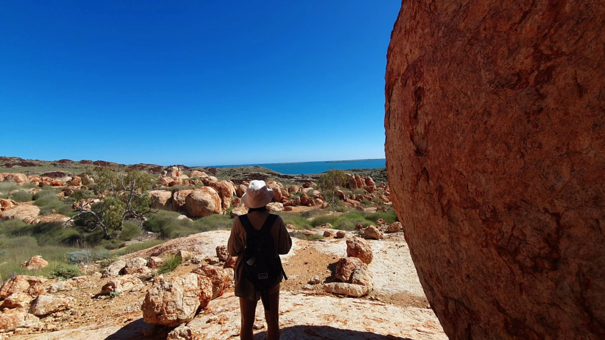
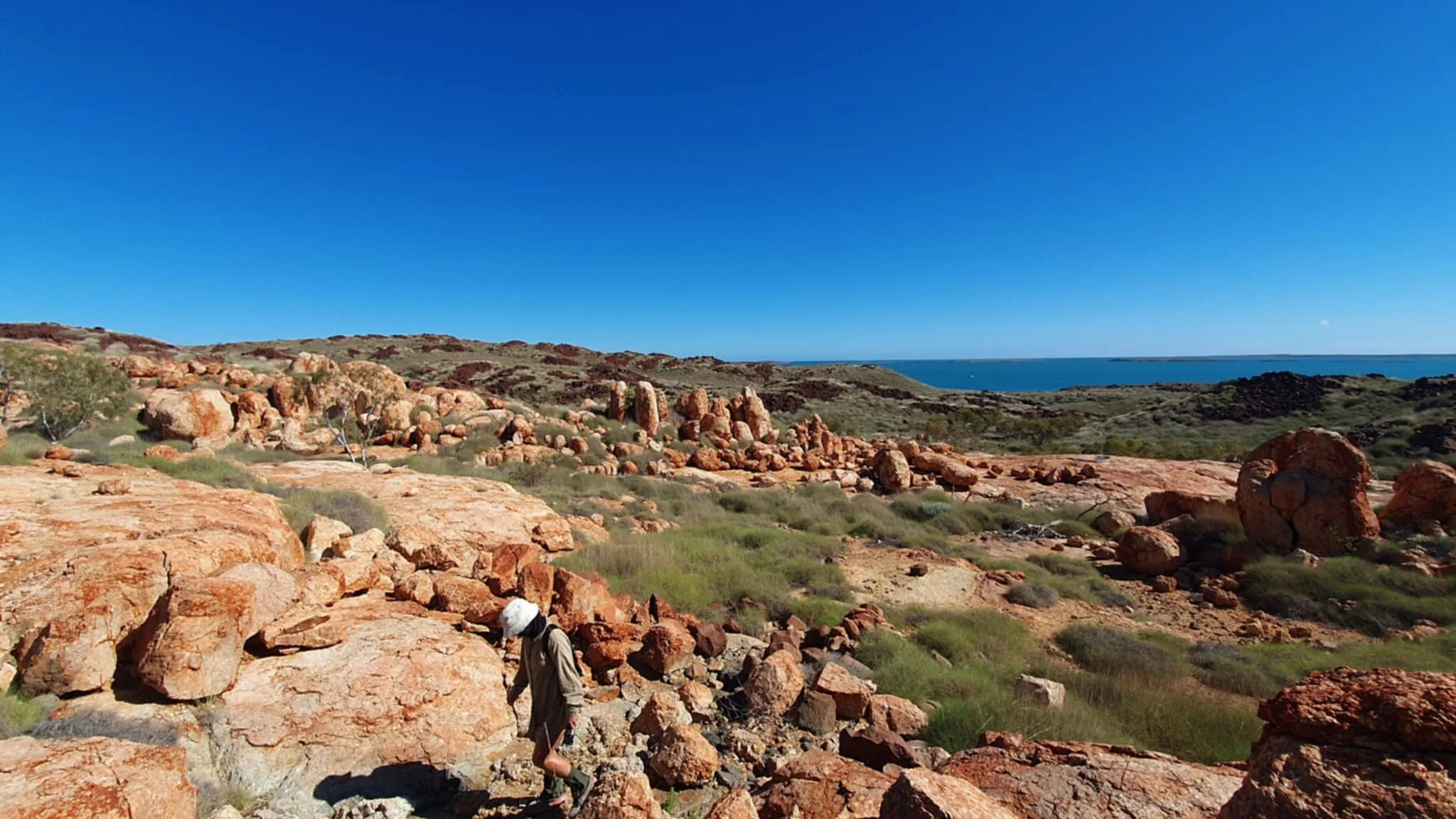
After a quick dinghy in we walked over a small dune to a large beach on the otherside of the island and then set about making our way towards the rock formations. This involved a beach walk, climbing a large rocky hill and then making our way through spinifex and rocks down to a valley from where we could access the rocks. Really interesting country and views from the top of the hills were fantastic; coupled with finding amazing petroglyphs on the rocks and then entering into a really amazing area of granite type rocks. What made it so amazing was these formations were completely different to everything else we had seen in the area so we knew they would have had significance to the indigenous and it was quite special making our way through the area. A lot of the rocks had been smoothed and sculpted by flowing water which made it all the more intriguing!


With an eye on the time we headed back to Singularity and hauled anchor, departing for Cape Lambert, a distance of about 20nm. As has been the norm the wind was ENE and thus straight on the nose pretty much, well about 30 degrees, so too tight to sail alone so it was motors and jib once more.
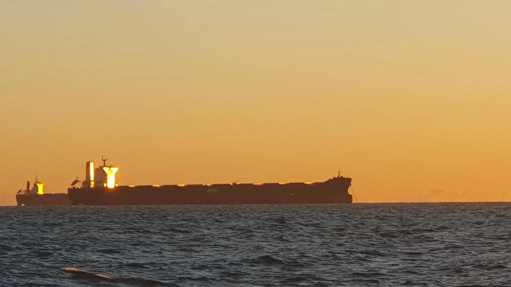
We arrived in the late afternoon and took up anchorage near Port Walcott and literally a stones throw from Rio Tinto’s Cape Lamber Iron Ore operation. Included in our anchorage was the hum of the conveyors, crushers and sorters dumping ore into the stockpiles, trains rumbling past, tugs coming and going and the ship’s pilot helicopter taking off just behind us. And of course all lit up like the Perth CBD!
After a roly night it was a 5am departure, slipping quietly right past the loading wharf where eight giant ore ships were being loaded simultaneously. The scale of the iron ore mining is mind blowing and although we had been exposed to it over the years, it certainly has ramped up to an unbelievable scale.


We had 30nm to travel to get to Depuch Island and it was a shitty old passage. The wind was 15 – 17knots, from the east of course and so at about 20 – 30 degrees and we had at least half a knot of tide going in the opposite direction making the sea state horrible. I was listening to Macca on the ABC and zoned out, getting wet from the sea state and having to stand most of the time as it was too uncomfortable to sit at the helm seat.
The wind dropped away as the day progressed and soon we were turning the corner into one of our favourite places, Depuch Island. Depuch had been a regular visiting spot when we were in Hedland for fishing and camping and we had been really looking forward to getting back here. The island has a really interesting history and there is a lot of rock art, as well as some graffiti from the early explorers such as the HMS Beagle in 1840. Having recently read the book on John Lort Stokes and the Beagle we were super keen to find some of the engravings they had left behind to record their passing.
We dropped anchor in the aptly named Anchor Bay and we were soon in the dinghy and heading over to the beach. Anchor Hill is located at the eastern end of the beach and this is the site of a significant number of petroglyphs and some historical ‘graffiti’ from the early explorers. We had an awesome few hours poking around finding loads of artwork and generally taking in the views of the island and surrounding waters. We headed over to wreck point, past the wreck of the Crown of England, which was lost in a cyclone in 1912 with six people losing their lives. On Wreck Point there is more petroglyphs, at least one gravesite and some more historical ‘graffiti’ so we enjoyed having a good look around and tramping up more hills!


Depuch treated us to a glassy windlass afternoon and we enjoyed watching the sun disappear over the island. Both Nic and I agreed that we could have spent many more days here as it is such an interesting place to explore – and we hadn’t even hit the water activities! However, we had more miles to make and it was once again an early start heading east towards Port Hedland.
There are not too many protected anchorages in this stretch from Depuch eastwards and so after 40nm we pulled in at Cape Thouin with an eye on exploring the major creek system here. The coastal strip here consists of long shallow sand areas and so we found ourselves anchored nearly two miles offshore at Cape Thouin. We made the long trek into the creek system and had a look around but the tide was receeding quickly and we didn’t fancy another 8 hours in the mangroves waiting for it to return so we headed back out to the sandbar at the entrance. Nicky went walking and I chucked a lure around the creek mouth for half an hour or so, only to lose one of my favourite lures to a massive sting ray!
We got back to the boat and things were getting a bit lumpy and in checking the tide we discovered that we were slightly out and so it was going to be a bit shallow for our liking. We quickly got organised and pulled the anchor, heading back out on our incoming track. There was some cause for concern however as we had passed over some shallow spots on the way in and these were now really shallow! We eventually settled in about 5 metres of water, about 3nm off the coast and feeling like we were sitting in the middle of nowhere!
Another roly night was endured before the sun rose the next day and we had a cruisy 20nm to Port Hedland. We were super excited – we were going to be reunited with Jemma; and Hedland was our first country posting and held a lot of really great memories, albeit 30 years ago!